Monday, August 9, 2010

NO MAS

We're done, it's over.
Long slide show and presentations tonight - and I'm on the road early.
So, my post will wait until tomorrow sometime.

Later.

Day 30: Ashland to Yorktown and Williamsburg, VA


NO MAS. Done.
Will be good to have a day off the bike.

Relatively leisurely day dropping down off the piedmont to the very gently rolling, pine forested flatlands. Progressively increasing tourist influence and Williamsburg is a big tourist trap. Continued on through Williamsburg down to the shore at Yorktown for a chance to dip the bike into salt water, go for a swim, have a picnic.

I rode 3500 miles and waited until about 5 miles from Yorktown to break a spoke - made quite a loud noise, and slowed me down fairly promptly. So, opened the brake, limped a couple miles to a support van, changed wheels for the rest of the day.

Warm,humid but pleasant day.

After lunch and before riding the 14 miles back to Williamsburg and the hotel, took a ride and walk around the Yorktown battleground. Pretty interesting to see it in real life - those guys were looking down each others throats and with pretty small defensive earthworks, and little to fight back with, I agree with Cornwall - time to quite while some of us are still alive and let the damn colonists have the place.

We started early today: great sunrise on the road.

For the first time, we all rode together for the last 2 miles - 38 folks in a double line - made for a big group. Then, cringe, got a chance to test how nice drivechains and carbon frames held up to salt and sand!

By the end of the trip (and before the salt and sand) all those quiet, newly tuned bikes were making an awful lot of creaks, squeaks and groans. As were the riders.

5.8 hr, 151 km (90 mile), 87 av heart rate, 16.1 mph.

Sunday, August 8, 2010

Summary: EFM

Don't do something like this to see the country - if you do it, do it just to ride a lot. Too much time is spent riding to really enjoy what you're seeing.

Don't do it to have fun, it isn't much fun - but it is a major accomplishment. And is enjoyable, if not fun.

Remember, There aren't too many other things in life that we do every day, no interruptions, with some days being very hard - for 30 days straight. Every day. Did I mention - every day? Hard work? Every day.

Don't do it to meet a wide variety of people: many if not most of the people on a ride like this are so focused on riding that they don't have too much besides bicycling to talk about. And, your day is so tied up with riding, caring for the bikes, ingesting enough calories, that there isn't a lot of time for interacting with people.

If you want to "see" the country, plan on 60-80 miles per day - and plan your route to take in the history and the culture. And, leave time to visit the sights, and enjoy the people. And, take a day off every week or two.

The country is really big, and really interesting, and I wanted to stop and talk to folks, and see stuff and take side trips. Would like to do it again and take 2 months to do it - or do it in sections. Did I mention, the country is really big!

It isn't really that hard if you don't get competitive and go hammering along too much (though you can certainly do that at time: a few days we had great fun racing each other up each hill, and once I settled in, I did occasional days of hard intervals). Treat each day as a long but easy recovery ride and you'll go plenty fast enough, and have plenty of gas to complete each day sand be ready for the next.

Pacing came surprisingly naturally - I couldn't believe, on the first few days, my low heart rates. But that persisted, even when I consciously tried to go harder: my body just said "Dude, you're gonna be out here for 8 hours - 90 beats per minute will be just fine!"

I never really had any severe sore spots - just occasional twinges here and there (butt, knee) and for the long days on the plains, my neck was sore - not too unexpected considering the injury last fall. I never had any days where sagging was a consideration (Yes, I did EFI - Every Fabulous Inch), nor days where I felt like I was dragging to the finish (though some days, I treated the last hour or two as a very leisurely cruise), nor days when I felt like I might collapse of exhaustion or heat (heat was a significant issue for some people, not much of an issue for others including me).

Many folks entered and left this as a huge life event: desperately wanting to do EFM and disappointed if not successful. They got pretty emotional when they finished. It was a big enough deal that there were some tears at the finish, and about 15 families that had come in from all over the country to congratulate (Dad, son, husband, wife, etc) finishers.

9 of the clients were women - reportedly the largest group ever - of 38. Several on recumbents rode near the back - a function of the bike. Others rode near the later part of the pack. There were 2 hammerheads that rode hard and looked uncomfortable. And, the young Swiss woman would have buried 9 out of 10 of the men - but rode all day, every day, on the wheel of her partner who was the hammerheadiest of the hammerhead guys.

Youngest was 17 years (2nd transcontinental for him - and he was a license plate collector for a hobby). Oldest was 71. Many were quite overweight - tough in the hills, non-issue on the flats. One was using it as a fund raiser for diabetes research - pulled in $20,000.

There were 3-4 that hammered hard, were fast, and off the front every day - alone on their aerobars. There was a group of 5-6 that rode in a fast paceline at the front almost every day. The recumbents brought up the rear. And there were several groups of 3-5 that typically were just in front of the recumbents and rode pretty slowly most days - and some days, some of us from the middle would drop back to these groups and ride with them for a more relaxing pace, often taking major pulls for them. The rest of us rode either alone or in varying mixes of 3-5 person groups in the middle, often mixing and matching between and within days - riding alone at times, and joining forces as winds, paces, and tiredness dictated. Occasionally a stronger rider riding at a comfortable pace would pick up a few followers and pull them along for many miles to the benefit of all. (There were times when I felt strong, but didn't particularly want to go fast, and between 1 and 4 folks would latch onto my wheel and stay there for a long time. On the other hand when I wanted to go slow, I preferred to just get down on the aero bars and cruise along easy - I believe that I've roughly tripled my total lifetime experience on aerobars!)

I liked to ride with a pace line at times, but rode a majority of my time alone so that I could look around at the scenery and have more freedom to stop for a photo or to read a roadside sign.

iPods were prominent: some used them all day and rarely spoke. I liked to put on some tunes late in the day when groups tended to splinter, and I would choose music based on mood and pace. Never pulled it out before lunch.

Funny experience to get to 100 miles and say, glad that we've only got another 20 to go today.

Photography on the fly was prominent, and somewhat surprisingly, caused no mishaps - even when 38 people simultaneously reached into a rear pocket on the last day to photograph, on the move, the sunrise!

7 crashes on the trip, the rumble strip that several of us found on day 1, one high speed with a little concussion and a few lower speed tipovers including in the parking lots.

My laptop and Wikipedia and Google were great for reading up on towns we visited, and geology, and history, and culture. iPad would be even better. And, for a quick update, the Blackberry in my pocket with Google or Wikipedia gave me quick information when we stopped for breaks and lunch (and for keeping up with the TourdeFrance and World Cup during the first week).

The wood-framed master map that was carried along and updated daily, and signed by all at the end was auctioned off for charity at the end: $1100. Only Canadian and Australian bidders! Go figure.


A few practicalities:

I used mini clip-on aero bars. A life saver when riding alone both to gain a fraction of an MPH and save time in the saddle, and to rapidly abolish symptoms when the hands went numb. (Yes, a few people had bad enough neuropathies by the end that working on the bikes, changing tires, etc. were very difficult.)

Although Lon recommended standard wheels, many of us took aero wheels - lots of Ksyriums, and Dura-Ace in my case. I lucked out in that my spoke didn't break until the last 5 miles, but with spokes not really being field replaceable on these wheels, it would have been a real problem if it happened earlier - involving a FEDEX overnight delivery of a new wheel. If you ride a tour like this, use standard-spoked handbuilt wheels - and carry spare spokes.

Insulated water bottles are life savers!

Next summer, I'd like to do a transcontinental of Europe - any takers? Look at the Oriental Express on www.tourdafrique.com - Paris to Istanbul in 6 weeks.

Thanks to all who have read this stuff, who have posted comments, and who have expressed interest. I guess I'll go back to work now..

Sorry if today's post was TMI

This will be my last post unless I have some late epiphany.


Day 29: Harrisonburg to Ashland, VA


UNO MAS!

Note well: I may never, ever, have said this before, but I'm looking forward to day off my bike!

Today, left the Shenandoah Valley, short climb up over the Blue Ridge, crossing the southern end of the Skyline drive, fast descent down to the Piedmont. A pretty section of the ride, but not really any views because of the thick forests.

Then rode across the entire Piedmont to Ashland which is right near the fall line, where we'll descend the last couple hundred feet to the coastal plain. The Piedmont itself is lots of rolling hills. Supposedly jumbles of various bedrocks crunched up when America was in contact with Africa - several decades or more ago. The bedrock is then really old, and really worn down. And, has had a lot of filling in with sediments worn down from the higher Alleghenies. So, as we rode along, we saw occasional outcrops of various kinds of rocks - mostly granites and metamorphics. Mile after mile of short ups and downs, hard to keep a steady rhythm. Slow going because of the terrain, a headwind, and really tired legs.

Lots of forest interspersed with large farms and towns.

Passed Montpelier, home of James Madison - 4th president. And, lots of signs pointing to various Civil War Battlefields. Closest to Chancellorsville and The Wilderness. The northerners won Chancellorsville, but then retreated. A year or two later, under US Grant, the northerners didn't do as well at the Wilderness, but advanced anyway putting enough pressure on Lee to eventually finish the war.

Stopped at a "re-enactment" encampment by the Montpelier civil war re-enactors. Pretty interesting. I'm not too sure why someone would like to put up a tent, get out some old clothes, and sit around looking old all weekend, but..... Got to hear a long discussion of how them Northerners had a big advantage of having most soldiers equipped with rifles (accurate out to 300 yards) while the South was limited largely to smooth bores (accurate only to about 100 yards) even out to the end of "the war". The locals still seemed a little annoyed at having lost the war.

We're in Ashland, like Richmond, at the edge of the Piedmont - the fall line where rivers and streams head down to the coastal plain - so both the end of navigation from the sea, and a good source of water power for mills. Therefore, a popular location for towns all up and down the eastern seaboard - and the route for US Route 1 which connects all the cities on the fall line.

We're in Kudzu land now!

Note the bicycle route sign: 76 is for the "Bikecentennial Route" which we followed part of the day.
Tomorrow - on to salt water.

7.8 hr, 197.5 km/122 miles, 15,6 MPH, 90 pulse.

Saturday, August 7, 2010

Day 28 a few more photos


Day 28: Elkins, WV to Harrisonburg, VA


Today was as good as it gets!!! Fantastic riding over ridge after ridge after ridge of the Alleghenies all day. Pretty little farms and villages, quiet roads with trees for shade, fog in the valleys in the morning. Some roads were just tunnels through the trees.

As everywhere in the east, impressive court houses in little county seats.

I counted 9 ridges that we climbed over for a total of about 10,400 feet of climbing. Kinda like doing hill repeats on Flagstaff - 9 times.

Some of the folks were pretty tired, but if you didn't hammer every climb it was a very pleasant day - exceptional riding.

Warm, but not as humid as it has been.

4 foot rattlesnake crossing the road. Pretty cool. He even rattled for me.

Couldn't find much interesting about Harrisonburg except that Janet Reno called it "the methamphetamine capitol of the East."

We are now in our last state.


Went through Seneca Rocks. Jean and I were there to climb in the 70's when the village consisted of one old general store that still had a phone that you cranked to get an operator, and give a phone number verbally. The town has tripled in size: 3 buildings now. The old store is gussied up and painted. There's a newer "family" restaurant. And, across the street is a climbing guide operation with a huge outdoor climbing wall (for training, I presume) and a yuppie coffee shop!

7.9 hours, 171 km (106 mile), 99 pulse av., 13.5 mph av,
10400 feet climbing.

Friday, August 6, 2010

Day 27: Parkursburg to Elkins, WV


What an exceptional day of riding. Some of the day was on a busy 4 lane with good shoulders, but once we were off the 4 lane we were in the forest with small farmhouses - some modernized, some run down, and some abandoned. Looked for, but didn't find, an old lady smoking a corncob pipe. Little narrow roads, little traffic, up and down over ridge after ridge after ridge, along little streams, shaded by thick trees, chased by farm dogs (mostly, actually all, just glad to run along side us for a little while). Agriculture was all small fields for hay, a few little plots of vegetables. Looks like hard to make a decent living, but real pretty.

Nothing much to take a picture of, but the overall effect of delightful riding and pleasant surroundings was quite exceptional. For those from Boulder, think 70 miles of old Apple Valley Road with a few more trees and more abandoned house and for sale houses.

We finally did our first "tour" of something today: ate lunch at the Trans-Allegheny Lunatic Asylum (really!). Took a 20 minute tour of the old hospital (in the picture). Peaked at 2600 "patients" (inmates?) in 1967 and was down to 141 when it closed in 1994. Thanks to the Thorazine that they used to dissolve in the coffee and sneak to the people.

Note the rather tired looking riders - interesting, that we all are getting to look a bit bedraggled.


Second flat tire of the ride today. And, a weird mechanical: the glue holding my cadence magnet must have loosened in yesterday's deluge, the magnet came off and was strong enough that it jumped to and attached itself to my chain and was then pulled into the derailleur. Took more than a little while to find the little tiny magnet, and sort out what happened! No power readings today and until I get the magnet glued back on.

Although billed as 9000 feet of climbing today, it only read (and felt like) 6000 feet on my Garmin.

7.8 hours, 122 miles/201 km, 99 pulse, 16.0 MPH (tailwinds again).

Wednesday, August 4, 2010

Day 26: Circleville, OH to Parkersburg, WV


Today, up onto the Allegheny Plateau. It's an uplifted area west of (and immediately adjacent to and in contact with) the Allegheny/Appalachian mountains. The plateau is uplifted as a block with basically horizontal sedimentary strata, whereas the mountains to the east are tilted up with sharply inclined or near vertical strata. We're going through the southern part of the plateau which was not glaciated in the most recent glacial era, so wasn't buffed by the continental ice sheets and therefore has sharper relief and erosion than the northern glaciated portion of the plateau. It's not a plateau recognizable to us westerners: it's so old that more of it consists of the eroded gullies, ravines, and valleys - and when one is actually on the plateau, it doesn't seem flat at all.

At the eastern edge is a fault that separates the plateau from the Allegheny mountains which are parallel ridges comparable to the front range ridges.

Today we rode the first half of the plateau, to the Ohio River which cuts through the plateau from Western Pennsylvania. The area is known as Hocking Hills, and consists of the heavily furrowed/eroded western edge of the plateau and is quite a jumble of small cliffs and bluffs of sedimentary rock and broken off pieces of the cliffs. Might look like this in some parts of Utah if Utah had trees. Tomorrow we ride the second half of the plateau and Saturday start through the Allegheny ridges.

Sorry, no pictures - rain day and kept the camera hidden.
The image is Wikipedia's terrain map showing the boundary between the plateau and the Allegheny Mountain ridge system.


Never climbed as much as 300 feet at a time today, but it was all up and down and up and down.

Our destination town is Parkersburg, named after Fess Parker. (For those of you too young to know, or for our Australian-speaking friends who may have missed this: Fess Parker played Davey Crockett (King of the Wild Frontier) in the TV show of the 1950's - perhaps the most important cultural event of the era - along with Roy Rogers. The premier scene of the series involved Davey firing his muzzle loading rifle over his shoulder, striking numerous candelabra and other metal pieces around the fireplace, and finally catching the bullet in the gap in his front teeth. In doing so, he won some sort of bet from his nemesis, Mike Fink, shortly after "rasslin' a 'bar'" - the days before spell-checkers. A true tour-de-force in the pre-photoshop era.) Unfortunately, Wikipedia has it all wrong and claims that Parkersburg was named after some guy who lived there right after the Revolutionary War. I'll have to edit the Wiki entry to set folks straight.

Heavy thunderstorm at 8:30 AM with lots of lightning along the ridges while we rode in the valley. Pretty spectacular. Then, light rain for a few more hours and a fantastic afternoon through the valleys and over the ridges eventually following a tributary down to the Ohio River.


5.9 hr, 163 km/103 miles, 2931 kJoule, 103 pulse, 154 watts, 27.9 km/hr (17.5 mph). Unsure of total climb - the rain interferes with altitude on the Garmin. (Reportedly about 6000 ft - seems like an overestimation, though climbing 100 feet 60 times may not be that far off.)


Day 25: Troy to Circleville, OH


WARNING! Heat advisory! Avoid all outdoor exertion today due to excessive heat index and chance for heat stress induced illness. NWS.

Dude! They were right. It started hot and humid, and ramped up from there. The tailwind made us fast, but made us even hotter (and wetter). When we got to Circleville, and rolled into the first coffee shop we were a wet, smelly, bedraggled lot - that chilled so quickly in the air conditioning that we had to run outside occasionally to warm back up - that didn't last long, too hot, back into the AC.

Gradual transition from the overall impression being vast expanses of cultivated fields with periodic remnant woodlots, to generally forested land with fields cleared in the forests. We got close enough to Dayton and Columbus that some stretches were clearly suburban "ranchettes" - 5 acres with house and pond and maybe a small barn (think the communities east of Lafayette, or the Erie airport without the landing strip and hangars), in small groupings of 10-20 homes.

Passed through some stretches of long rounded ridges - perhaps 100 - 200 feet high - that, if I read my Wikipedia correctly are remnant moraines from the continental glaciers. See picture.

Plenty of small industrial operations: metal fabricating, some electronics manufacturing, farm implements - presumably the outliers of the "industrial heartland".

Talk about getting "dropped by the peleton": at one point, the trailing edge of a cloud shadow was about 25 meters ahead of me, and (shadow being cooler than blazing sun) I tried to make it up into the shadow and chased it full gas for a couple kilometers without ever quite making it into the shade. Suppose it was hopeless anyway, since I suspect that once I caught the shadow I wouldn't have picked up a draft anyway.

We came out of the finishing coffee shop to find a fast-advancing wall of black clouds and made it over to the hotel just in time to run inside from the thunder, lightning, howling wind, and torrential downpour that last half an hour, prompted numerous weather alerts and some flooding north of here, and left us with much cooler, drier air afterwards. (Note the faint semicircular arc of wind-driven mist coming off the left edge of the roof of the blue car in the picture.)

The towns we rode through today seemed to have this thing with county courthouse buildings - must have been a competitive thing - ornate, stone buildings with decorations and big towers.

BTW Circleville was named after circular mounds from early native Americans back predating the modern "Indians" (Hopwell culture, 500 BC to 200 AD). The town was built on the circular mounds, and laid out in a circle. In the early 1800's they figured out that this was impractical and "The Circleville Squaring Company" (great name) was commissioned to reconfigure all the streets. It's now square middle america with no remnants of the original mounds.

5.2 hr, 150 km (94 miles), 17.9 mph, 2408 kJoule, 371 meter climbing, heart rate 99, 141 watt av. (Did some longer intervals the last hour).

Tomorrow back to a bigger day with 6000 ft climbing.

Tuesday, August 3, 2010

Nate's pictures from South Dakota

For those who want some real pictures of the ride: here's Nate's contribution!!!


Thanks, Nate.

Day. 24: Anderson, IN to Troy, Ohio

More of the same: corn, soy, rolling hills in areas, mostly flat, country roads, small towns, old buildings.

Rest day - only 85 miles, tailwind so cruised along. First day in a long time riding less than 5 hours! Hot and humid but cooled down by light rain all morning.

Got to Troy so early that we went for a ride into town to do some shopping (and go to a Tim Horton's!)

For pictures, everything looked the same as yesterday. Sorry, none.

4.7 hrs, 134 KM (84 miles), 17.6 mph, 232 meters climbing, pulse 88, 136 watt average, 2145 kJoules. Have to watch what I eat tonight!

Day23: Danbury to Anderson, Indiana


Hotel had very limited internet, so didn't get this posted last night.
Still in the cropland of the central midwest: low rolling hills with mixed cropland (still corn and soybean, but now a few other crops like squash) and forest. Small creeks. Great cycling roads with little traffic and rolling hills and sweeping curves.
Lots of farm homes along the roads and frequent small villages.
The whole area - starting way back in Iowa is remnants of the continental glaciation: if I understand correctly, the area where we are now was under the ice sheets and is soil left when the sheets melted. The hillier areas in Iowa - and where we'll arrive in 2 days in eastern Ohio are the moraines at the edges of the ice.

The pictures are some decorations on the side of an old building, a tank care in a passing train - one of several hundred, it seemed, containing the future lard asses of American in the form of corn syrup, and a reminder plaque from the support van.

6.8 hr, 190 KM (118 miles), 17.4 mph, 88 pulse, 135 watts, 135 meters climbing, 3050 kJoules

Sunday, August 1, 2010

Day 22: southern Illinois Pelkin to Danburry


Today's ride may have been the most consistently unvarying that I've ever done: flat, corn and soybeans, and small towns, over and over and over again.

Started out in fog - rather interesting visual effects. One note: when we first started, a couple guys used tail lights. By now, about 2/3 of us seem to be using them all the time - give the trucks plenty of time to see us and take aim.

The smiley face water tower may have been the highlight of the day.

The abandoned barn seems to be a pretty typical sight around here - more abandoned barns then barns still in use.

Talked to a local guy about the silos: The large storage tank holds 100,000 bushels of "shelled" corn - corn kernels removed from the cobs. They can be stored for up to 5 years and are used mostly for milled products: corn meal, hominy grits, etc. The local mill where the kernels are processed after being stored here, closed a few years ago - either because other mills were more modern, or because the local mill was a union shop and others are non-union.

8.3 hrs, 222 km/136 miles, 26.8 km/hr(16.2 mph), 89 heart rate, 134 watts, 3766 kiloJoules, 412 meter climbing (hard to believe that any climbing actually happened).

Saturday, July 31, 2010

Day 21: crossing the Big Muddy


Mount Pleasant, iowa across the Mississippi to Pekin, Illinois

Close to the river, the Iowa terrain was broken up ravines - much less cropland, more forest and pasture. Then a steep drop down to the river, and suddenly we're in urban habitat: long towns along the river with old buildings presumably from days when river trade was more important than now. Presently, the riverside is developed into parks and the old buildings are being yuppified. And, of course, the floating casino.

Up the bluffs on the east side and onto near pancake flat cropland in Illinois until we hit a few drainages and then dropped down into the Illinois River Valley.

Quite a contrast with so many more small towns in Illinois than in Iowa.

Abe Lincoln memorabilia seems to be quite an industry: every little park seemed to have a plaque about a speech he gave here, or a still existing set of stairs that he climbed there, etc.

Pekin is known for the Pekin agreement where Lincoln and three other Republicans agreed to not compete, but to serially get themselves elected for one year terms (no viable opposition) to the Illinois House. Lincoln severed his year - his only "elected" office prior to being elected President. Presumably a low-life, smoke-filled room deal that would be condemned if perpetrated by some scoundrel rather than by such a heroic figure.

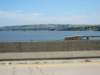
The bridge over the Big Muddy appears to be an old railroad bridge, with a car deck added over the rails as an afterthought.

Pleasant riding all day, light winds - sometimes helping, rarely hindering, broken clouds, pleasant temperatures.

We often were able to ride through detours on this trip (note the passage through the blockading backhoe). The last picture is the Illinois River.

Currently we've come 2445 miles out of 3415 - less than 1000 to go! In 9 days.

8.5 hours, 230 km (extra when we missed a turn) 139 miles (at least that's less than 140), 27.1 km/hr (16.8), 87 pulse, 137 watt average, 3728 joules, 852 meters climbing (2700 feet or so).


Friday, July 30, 2010

Day 20: Colfax to Mount Pleasant, Iowa

No pictures today, folks. Never got the camera out of the waterproofs.

Iowa turned from really flat to pretty hilly (though smaller hills) today with hardwood forest where it hadn't been cleared for crops. More small towns with a variety of old well-kept, old run-down, and newer homes. The farms appeared to be smaller and family owned - with a homestead on each section. More like southern New England or Pennsylvania farmland. Still all corn and soybeans as the primary crops.

Mount Pleasant has 8000 people, but has the Midwest Threshers Reunion every year and draws 100,000 visitors to see old farm equipment and listen to country music. sorry I missed it.

The day started raining within miles of the start, turned into significant thunderstorms with lots of electricity striking all around, heavy changing winds and heavy downpour for about an hour (no hail), then another couple hours of lighter rain and finally a few hours of sun. It was warm enough to be very enjoyable (at least to me) riding in the rain. Luckily I was at the lunch stop when the worst of the storm hit and just took a leisurely lunch and waited it out.

One epic mudbath construction area - about 50 yards of gooey deep clay well soaked by the rain. Unrideable. If you walked through in your shoes, the cleats became unusable. If you tried cleat covers, they got pulled off and lost in the mud. Socks weren't a good idea. So, most of us opted for what seemed the best choice, shoes and socks off and wade through the mud (felt good slooshing between the toes - apologies to the bard of Wasilla), then wash the feet in a puddle on the other side.

Plenty of climbing over those little hills, and plenty of head winds made it a long day.

9.3 hrs in the saddle (12.5 hr total because of the extended lunchbreak waiting out the worst of the storm), 226 KM (141 miles) at 24.3 km/hr (15.0 mph), 142 watts at 91 pulse, 4264 kJoules.

Epic delightful riding day.

Thursday, July 29, 2010

Day 19: Denison to Colfax, Iowa


Hi, kids! Today's words are boring and lethargy. Not sure which came first. The Iowa hills of yesterday became lower and lower and eventually it was just flat. No more terraces. No more contoured crop rows - the rows became straight where there were no contours to follow.

So, it was just head down into the wind for a lot of hours. Occasionally, look up and behold, more corn! Head down, and grind along. And for whatever reason, very little drive to keep going at any pace - until finally, the last couple hours - either the McDonald's milkshake, or a new selection of more energetic iPod tunes (East Village Opera and then some Natalie McMaster celtic) and I picked up the pace and drove home, found a few little hills to ride hard and reeled in a lot of the folks that had left me hours earlier.

Also, started to see more patches of woodland left from way back when rather than plains - looks like this must have been forested back before 1776 or whenever.

Found very little to take pictures of - flatland corn isn't that interesting. A bit of fog in the river valley as we started out this morning. The little town of Coon Rapids had a bunch of sculptures around its golf course and town park. Didn't get much better than that.

Colfax is a small enough town that the only restaurant is McDonald's - I'm getting to believe that McD's is truly America's finest cuisine.

8.7 hr, 219 km(134 mile), HR 88, 137 watts, 25.1 km/hr (15 mph), 3974 kJoules, 964 meters (3000 ft) climbing.

Wednesday, July 28, 2010

Day 18: Vermillion, SD to Denison, Iowa


Wow, I thought that 85 was pretty hot, but after 3 days in the 90's, 85 is downright cool. Throw in some nice rolling hills and favorable winds for about half the day, and bicycling becomes enjoyable - quite different from the survival sport of the last couple days (I almost got voted off the Survivor island, as many did).

As soon as we crossed the Big Sioux River into Iowa, the topography changed dramatically from flat prairie to rounded hills that had extensive crops (corn and soybeans nearly 100%), and in areas were terraced. These are the Iowa Loess Hills - similar to the Palouse of eastern Oregon and Washington, they are glacial outwash silt that has been windblown and molded into hills and are very fertile.

The hills are up to mostly only 1-200 feet high, but if you go up and down the things all day (on straight roads that just go up and down the hills), you can accumulate 5000 feet of climbing without any real change in altitude.

Talked with a woman in Rickets at one of our lunch stops: town of 1oo people, mostly old. 20 years ago a vigorous community with bowling alley, car dealer, and grocery store - now just old people mostly, including a retirement home. The family farms were all sold to big farm corporations and very few people are actually needed for the farming, so no younger folks left.

Saw something that we hadn't seen since the Black Hills: a curve in the road! Neat.

A few farms still left - they are pretty.

The hills were very pleasant riding: especially the chance to get my butt off the saddle for a climb every couple minutes.

Rather surprisingly I've survived a few tough, long days and now can seriously think of doing EFM (Every Fantastic Mile, or something like that).


8.0 hours, 206 km (128 miles), 25.9 km/hr (16.1 mph), 1755 meters (5750 feet) climbing, 3703 kJoules, HR 93, power 144 watts.

Tuesday, July 27, 2010


Today was another brutal day, though 2 hours shorter than yesterday: temp 95, heat index 105, head and crosswinds (12 mph into the wind, 15-16 in the cross winds). At least into the winds,pacelines worked well and we were on rural roads, so could echelon in the crosswinds. It was brutal (worse heat conditions than the last 2 days, though shorter), and with people already beat up and tired, the sag vans filled up fast.

I was reduced to putting 10-12 ice cubes in my shorts, and a couple more under a cap under my helmet before leaving each break spot. Then, when possible stopping at quick stop stores between the breaks.

Yesterday the land was flat, flat, flat. Today it was flat, flat, and then a stream or river valley cut 50-100 feet into the flatlands. Made it more interesting. Not much in the line of trees on the flatlands (telephone poles don't count), but cottonwoods in the valleys. Crops seem to be all corn and beans. So much of it that one begins to understand how we feed 300 million people - miles and miles and miles of crops (ready for making people fat on high fructose corn syrup, I guess). Fewer cattle hereabouts.

And big, really big farm machines.

Lots of old abandoned and run down farmsteads (look close in the 2nd picture). It appears that the little house on the prairie has now been replaced by the vinyl (siding) house on the prairie - plenty of those.

And Lutheran churches - with no evidence of anywhere for parishioners to live - just a church in the middle of the prairie with nothing around it for miles.

The river bridges are the Missouri River yesterday.

7.8 hours in the saddle, 185 km (115 miles), 23.5 km/hr = 14.6 mph, heart rate 88 at 128 watts 3390 kilojoules, 485 meter climbing.

Monday, July 26, 2010

Day 16 Murdo, SD to forever (well, Mitchell)

No pictures to post tonight - not enuff time.

Today was flat, except for down to and back up from the Missouri River. We're now out of the rain shadow of the Rockies, so crops can grow - lots of corn and other stuff that i didn't recognize.

Pretty yellow butterflies. A few pheasants to be seen. Not much else except for giant farm equipment - tractors, harvesters, etc. Equipment dealers, and big machines that took up 2+ lanes of road and we had to sneak by.

Brutal, brutal day. Heavy winds quartering into us from the south kept speeds low until the last hour - so 10 hours in the saddle. 90 degrees and humid. Lots of folks didn't make it, and many who did were pretty trashed by the end (me included). A near death experience.

And, although shorter by 30 miles, tomorrow is predicted to be worse - hotter, more humid, heat index of 102 and wind from the south - as we turn south. Can't wait!

I'll try to get up some pictures tomorrow.

10 hr in saddle, 237 km(147 miles), 23.4 km/hr (14,5 mph), 130 watts, 89 pulse, 4680 kilojoules (means I could eat a real lot - mostly as milk shakes - couldn't think of anything warm to eat).


Sunday, July 25, 2010

Day 15 the flats of South Dakota


Rapid City to Murdo, SD

Rolling grasslands, and grasslands, and grasslands.
A brief excursion through the weird and bizarre pinnacles of the Badlands. Last time we were there was in 1980 I think.

Hot. Crosswinds for most of the day: scrubbed off the speeds a little and very hard to help each other: echelons and double pacelines help, but take so much concentration that it's hard to enjoy the scenery or to keep it up for very long.

During the middle of the day we turned north for a while and had a fast tailwind respite, then back to the crosswinds.

Highlight of the day: car parked along the road, and as I drove by noted the giant bug-eyed glasses of Nate! Crazy dude drove up from Colorado (actually, all the way from Santa Fe) to take some pictures - so leap-frogged along with us for a while through the badlands. Then, he drove into Murdo, hopped on his bike and rode back to drag my sorry ass the rest of the way to Murdo - amazing how much easier that last 15 miles was with the chatting/catching up on the latest news. We'll eventually have some links to Nate's web site and his pictures from today.

Thanks, Nate for showing up - made it a great day.

The animal of the day was: GRASSHOPPERS!!!! Billions, and billions landing on every part of our bikes and bodies as we trundled along.

Pictures include: the PAC Tour version of a refugee camp, the long morning paceline that lasted for a few hours, the badlands, and the bugeyed photographer by the road.

8.8 hours in the saddle, 237 km(145 miles), 16.4 MPH, heart rate 93, av power 131 watts.